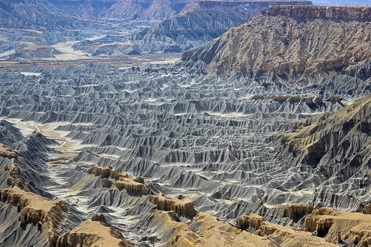
Drainage basin
A land area where surface water converges to a single outlet.

A drainage basin is an area of land where all flowing surface water converges to a single point, such as a river mouth, or flows into another body of water, such as a lake or ocean. It is separated from adjacent basins by a drainage divide, a perimeter of elevated features like ridges and hills. Drainage basins are fundamental units in hydrology, geomorphology, and ecology, and are also known by terms such as watershed, catchment area, river basin, and impluvium.
- world_land_draining_to_Atlantic
- about 47–48%
- world_land_draining_to_Arctic
- about 15%
- largest_river_basin
- Amazon (7 million km²)
Lore & Background
Drainage basins are defined by watershed delineation, a process used in environmental engineering and science. A basin may contain smaller basins that merge at river confluences, forming a hierarchical pattern. In a closed drainage basin, or endorheic basin, water converges toward an interior sink—such as a permanent lake, dry lake, or point of underground loss—rather than flowing to the ocean. Endorheic basins cover about 18% of Earth's land, with the largest in Central Asia, including the Caspian Sea and Aral Sea.
Reader's Guide
Drainage basins are critical for understanding the movement of water within the hydrological cycle. Most water discharging from a basin outlet originates as precipitation, though groundwater flow directions may not match surface drainage networks. Measurement of discharge is done via stream gauges at the basin's outlet. Rain gauge data is interpreted using methods such as the arithmetic mean, Thiessen polygon, or isohyetal method. In ecology, basins transport nutrients, sediment, and pollutants, affecting ecological processes. Geopolitically, drainage basins have historically determined territorial boundaries, as seen in Rupert's Land granted to the Hudson's Bay Company. Modern bioregional political organization includes interstate compacts like the Great Lakes Commission. Drainage basins are similar but not identical to hydrologic units, which allow multiple inlets, outlets, or sinks.
Did You Know?
- About 47–48% of the world's land drains to the Atlantic Ocean.
- The five largest river basins by area are generally the Amazon, Congo, Nile, Paraná/La Plata, and then either the Mississippi or the Ob depending on the ranking.
- Endorheic basins cover around 18% of Earth's land and do not drain to an ocean.
- In North America, 'watershed' commonly refers to a drainage basin, while elsewhere it may mean the drainage divide line.
Frequently Asked Questions
Who is Drainage basin?
A drainage basin is a stretch of land where every drop of surface runoff funnels toward one common outlet, such as a river mouth or a lake. It is bounded by a drainage divide made of ridges and hills that keeps it separate from neighboring basins.
What are Drainage basin's powers/role?
It serves as the fundamental working unit in hydrology, geomorphology, and ecology, organizing how water, sediment, and nutrients move across a landscape. By channeling all surface flow into a single exit point, it lets scientists track erosion, flood risk, and ecosystem health at a manageable scale.
How does Drainage basin's story end?
Every basin's narrative concludes at its outlet, where accumulated water empties into a larger river, a lake, or directly into an ocean. Globally, roughly 47–48 percent of land area drains toward the Atlantic while about 15 percent feeds the Arctic.
Why is Drainage basin important?
Because it defines the natural boundary within which all surface water interacts, it becomes the go-to framework for flood modeling, water-resource planning, and habitat conservation. Without that clear perimeter, predicting how an upstream storm affects a downstream community would be far more difficult.
What is Drainage basin's biggest rival?
The drainage divide—those ridges and hills forming the basin's perimeter—is the feature that prevents it from merging with neighboring basins. The Amazon, at roughly seven million square kilometers, stands as the largest single basin on Earth and dwarfs most of its rivals in scale.
More in Coastal And Fluvial Geomorphology 25-32
Elsewhere in the Coastal And Fluvial Geomorphology universe
Spotted an error? Know more?
This is a living reference — every entry is fact-audited, and reader corrections feed straight into our audit queue. Suggest an edit · See this site's audit record