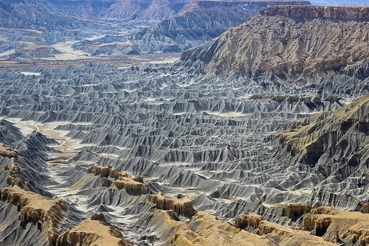
Endorheic basin
Closed drainage basins with no outflow to oceans.
An endorheic basin, also known as a closed, terminal, or internal drainage system, is a watershed that traps water rather than letting it flow out to rivers or oceans. Instead of draining to the sea, the water collects in permanent or seasonal lakes and swamps, where it eventually evaporates. These basins act as local base levels, meaning they set the boundary for how erosion and sediment deposition shape the surrounding land.
The word "endorheic" comes from the French *endoréisme*, combining the Greek *endo-* ("within") and *rheîn* ("to flow").
Lakes that form in these basins are called terminal lakes. Unlike most lakes, which drain into the ocean via rivers, terminal lakes sit in closed watersheds where the local landscape—often a mountain range—blocks any outlet. They are usually found far inland, in areas with low rainfall. Because water leaves mainly through evaporation and seepage, minerals and pollutants from erosion build up over time, making these lakes salty and especially sensitive to contamination.
Endorheic regions can appear in any climate but are most common in deserts, where low rainfall and high evaporation keep the basin floor from filling enough to spill over. In wetter areas, erosion from rivers or floods can carve an outlet, breaking the basin open. The Black Sea was once such a closed system before the Mediterranean broke through, and Lake Bonneville flooded out of its basin in a similar way. The Malheur/Harney lake system in Oregon, normally cut off from the ocean, has a dry outflow channel that may have flowed a thousand years ago. Even in humid regions, high-elevation endorheic basins can be marshy and flood-prone, as seen near Mexico City, where annual rainfall of 850 mm creates waterlogged soils that need draining.
Because inflowing water can only escape through seepage or evaporation, dissolved minerals are left behind, forming salt flats, playas, or alkali flats. These large, flat surfaces are sometimes used for runways or land-speed records. Australia has the highest proportion of endorheic land at 21%, while North America has the lowest at 5%. About 18% of Earth’s land drains to endorheic lakes or seas, with the largest such area in interior Asia. In extreme deserts with no drainage at all, the basin is called arheic. Both permanent and seasonal lakes can form, though even permanent ones shrink or split during dry seasons. Some basins are now dry because climate change reduced rainfall enough that a lake no longer forms.
- highest_percentage_by_continent
- Australia at 21%; Antarctica has about 18%, which is higher than North America's 5-10%.
Lore & Background
Endorheic basins are typically located in the interior of a landmass, far from an ocean, and in areas of relatively low rainfall. Their watersheds are often confined by natural geologic land formations such as a mountain range, cutting off water egress to the ocean. The inland water flows into dry watersheds where the water evaporates, leaving a high concentration of minerals and other inflow erosion products. Over time this input of erosion products can cause the endorheic lake to become relatively saline (a 'salt lake'). Since the main outflow pathways of these lakes are chiefly through evaporation and seepage, endorheic lakes are usually more sensitive to environmental pollutant inputs than water bodies that have access to oceans, as pollution can be trapped in them and accumulate over time.
Reader's Guide
Endorheic basins are significant because they represent a major component of Earth's hydrological system, covering about 18% of the planet's land area. They are most commonly found in desert locations, reflecting the balance between tectonic subsidence and rates of evaporation and sedimentation. These basins are vulnerable to pollution and climate change: because water can only leave through evaporation or seepage, pollutants and salts accumulate, and human activities such as dam construction have caused many endorheic lakes to contract dramatically, increasing salinity and disrupting ecosystems. The desiccation of saline lakes produces fine dust particles that impair agriculture productivity and harm human health. Anthropogenic activity has also caused a redistribution of water from these hydrologically landlocked basins, contributing to sea level rise. Notable examples include the Caspian Sea, the Chad Basin, and the Okavango Delta.
Did You Know?
- The term 'endorheic' derives from French 'endoréisme', combining Greek 'éndon' (within) and 'rheîn' (flow).
- The Black Sea is sometimes speculated to have been an endorheic lake, but the geological consensus is that it had outflow via the Bosporus and was not strictly endorheic.
- Australia has the highest percentage of endorheic regions at 21%, while Antarctica has about 18%, higher than North America's 5-10%.
- Endorheic basins often contain extensive salt pans, which are sometimes used for aviation runways or land speed record attempts.
Frequently Asked Questions
What exactly is an endorheic basin?
It is a drainage area in which water has no channel or pathway to reach the ocean or any other external water body. Rainfall and runoff instead collect in lakes, swamps, or salt flats within the basin and ultimately vanish through evaporation.
How does water actually leave an endorheic basin if there is no outflow?
Because no river or stream carries water out of the system, evaporation into the atmosphere is the only real exit. The internal lakes and wetlands shrink and expand seasonally until a moisture balance is reached.
What other terms do geomorphologists use for endorheic basins?
You will also encounter the labels closed basin, terminal basin, and internal drainage system in the literature. All three names highlight the same defining trait: no hydrological connection to the outside world.
Which continents have the highest share of endorheic basins?
Australia leads with roughly 21 percent of its land area falling within closed drainage systems. Antarctica follows at about 18 percent, while North America registers a lower 5 to 10 percent.
Why do endorheic basins matter for erosion and deposition in nearby terrain?
They serve as local base levels, setting the lowest elevation to which surrounding rivers and streams can erode. This imposes a hard limit on how far fluvial processes can carve valleys or deposit sediment in the adjacent landscape.
More in Coastal And Fluvial Geomorphology 1-24
Spotted an error? Know more?
This is a living reference — every entry is fact-audited, and reader corrections feed straight into our audit queue. Suggest an edit · See this site's audit record